

Plan-de-la-Tour
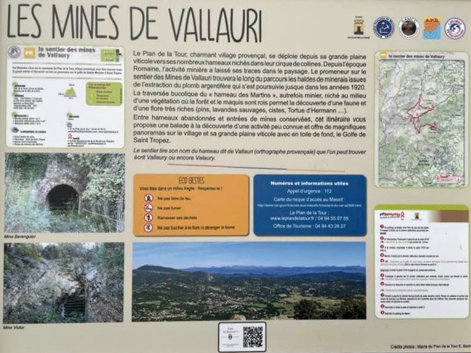
This itinerary, located in the commune of Plan de la Tour, a Provençal village, will take you back to the mining past and give you a panoramic view of the gulf from Sainte Maxime to Saint Tropez. 1 From the car park, head towards the city stadium playground. Turn right onto the stony track which climbs steeply.
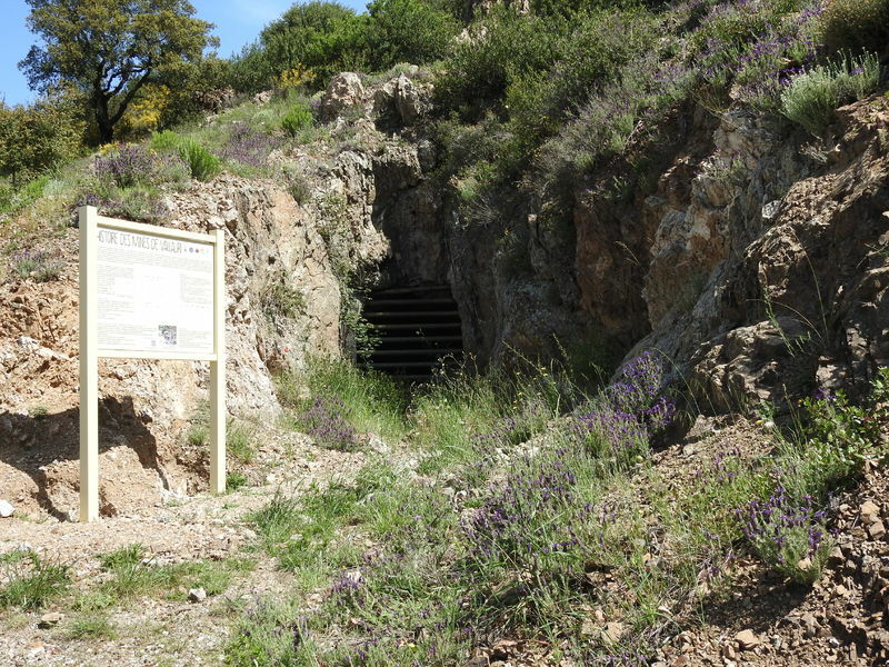
2 At the crossroads, turn left onto the E743 track [ > A mine entrance on the right] which climbs for 1.6 km.
3 At the crossroads, take the C744 track on the right for 230 m
4 Go up to the right on the stony track to reach the viewpoint
4 [ > Panoramic view of the Gulf of Saint-Tropez, the Pointe du Rabiou and the peaks of Saints Peire (403m) and Sébastien (333m)] (250 m outward and return journey) Return to point 4.
Take the C744 track on the right and reach a crossroads (cistern).
5 Turn left on the stony path, eroded and gullied in places, which descends the slope.
[From point 5, walk about 300 m to see the entrance to the Victor mine on the left].
6 Continue downhill and join the Marri Vallat valley (intermittent stream). [Old extraction slag heap, on the right Berenguier mine].
7 Turn left onto the dirt track lined with cyst, heather and myrtle. Pass a shed and reach the ruins of the hamlet of Les Martins, a reminder of life in the hills in the past. Then go up a few steep slopes and reach the crossroads.
3 Take the track on the right and join point 2
2 Reach the starting car park.
https://tourisme.leplandelatour.fr/files/leplan/tourisme/ficherandonnee-leplandelatour.pdf


Prestations
Free access.
€ - €
- Level bue - Medium
- French
- Car park
- Pets welcome
- Gradient : 334 m
- 7 km
- 150 min
- Stone Ground Grit Not suitable for strollers
Address
Les mines de Vallaury
7 place Clémenceau
83120 Plan-de-la-Tour
7 place Clémenceau
83120 Plan-de-la-Tour
04 94 43 28 27
-
04 94 55 07 55
leplandelatour@golfe-sainttropez-tourisme.fr
www.golfe-sainttropez-tourisme.fr
leplandelatour@golfe-sainttropez-tourisme.fr
www.golfe-sainttropez-tourisme.fr
Opening
All year round.
-
December 2024
L M M J V S D -
January 2025
L M M J V S D -
February 2025
L M M J V S D -
March 2025
L M M J V S D -
April 2025
L M M J V S D -
May 2025
L M M J V S D -
June 2025
L M M J V S D -
July 2025
L M M J V S D -
August 2025
L M M J V S D -
September 2025
L M M J V S D -
October 2025
L M M J V S D -
November 2025
L M M J V S D